
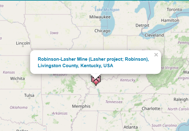
Robinson Lasher
| Property | Area Acres | Historic Resource Estimate (tons)* | CaF2% | Zn% |
|---|---|---|---|---|
| Robinson-Lasher | 1,524 | 31 | 14 | |
| Robinson-Lasher Bethel Horizon | 70,000[1] | 32 | ||
| Robinson-Lasher Shetlerville Horizon | 105,000[2] | 30 | ||
| Robinson-Lasher sub-Rosiclare Horizon | 387,225[3] | 5 – 10 | 14 |
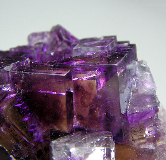
Robinson-Lasher Showcases Zinc Potential
The Robinson-Lasher property, encompassing 1,524 acres in Livingston County, sits along the Robinson Fault, a near-vertical structure with 20,000 feet of total strike length. The property controls approximately 1,700 feet of the fault system, where bedded replacement deposits have been developed through a 1,270-foot decline to 240 feet vertical depth[39].
This property has undergone extensive exploration with 232 core holes to at least 9,855 ft with a historic resource of 70,000 tons grading 32% CaF2 (Bethel Horizon), 105,000 tons grading 30% CaF2 (Shetlerville Horizon) for 175,000 tons fluorite. (1, pp. 68–70). There is additionally another 387,225 tons grading 14% Zn in lower sub-Rosiclare with 5-10% fluorite according to an internal Dynamex company report[40],[41]. Total footage comes from a Boyce Moodie memo dated April 20, 19761. Dynamex exploration[42] demonstrated that 77% CaF2 grades are achievable in certain intervals, though typically over smaller thicknesses.
[1] Mining & Minerals Services, Inc., 2011, Western Kentucky fluorspar & zinc project prospectus: Mining & Minerals Services, Inc., Marion, Kentucky, 24
[2] Mining & Minerals Services, Inc., 2011, Western Kentucky fluorspar & zinc project prospectus: Mining & Minerals Services, Inc., Marion, Kentucky, 24
[3] Gatten, O.J., 2008, Shawnee zinc exploration project, Hampton prospect, Livingston County, Kentucky: Kaysville, Utah, North American Exploration, Inc., unpublished report prepared for Cheryl Wilson, Dynamex Resources Corporation, 117 p.